Flight Date: April 29, 2017.
Departing Nashville, heading west.
Departure: JWN
Destination: CKP (we planned to IKK, then switched in the air to DVP, then again to CKP)
Engine on: 11:30 AM CDT
Hobbs: 4.0
Gallons: 50.07
Distance: 562 nm
A stationary front had been bathing a long stretch of the central United States, ranging from Texas all the way to New York. Intense storms and flooding had been felt in Kansas, Missouri, Illinois and Ohio. We had been watching the front for a couple of days, as it posed an obstacle for our western destination. On our departure date, early in the morning, intense thunderstorm activity peppered the whole area.
Our planned departure time was 9:30 AM, but a two-hour intense weather-gathering process delayed it until 11:30 AM. We were evaluating two possibilities: fly north towards Chicago, where the storm seemed to have calmed down creating a 200 nm hole with intense rain, but no thunderstorm activity; or fly west towards Texas, where the weather seemed benign, but where we would still face uncertainty on the place where we would finally be able to turn north. At some point we were considering crossing the mountains around El Paso, the southernmost possible route, to evade the system.
The northern route entailed the risk that, as the day got warmer, thunderstorms would show up again in the hole we had identified. If we were pushed to the north east by the storms we might find ourselves north of the storm, but with lake Michigan on our path, a no-no without the appropriate over-water equipment. In that case, we would push north towards Michigan, heading west over Canada, increasing our distance significantly. Furthermore, the storm was predicted to twist back towards the planes, engulfing Iowa, Nebraska, and Wisconsin, potentially preventing us from flying west at all. We might spend a day or two in Michigan, a delay we would rather not have.
The Texas route entailed good weather but significant headwinds, we would be flying about 120 kts over the ground, a return to Tweety speeds. Furthermore, once in Texas, there was no certainty that a new crop of thunderstorms would not prevent us from arriving at our destination, nor that we could turn north given forecasts of snow in Colorado and Nebraska (forecasts that were spot on, Nebraska got up to 18 in of snow that day.)
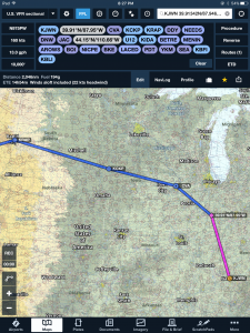
The hole up north seemed to be closing up and we filed an IFR flight plan for Gainesville, TX (GLE) and prepared to leave. Yet, as we took one last look, the hole seemed to open again! Looking at the weather and talking with a briefer to discuss Texas versus the north took another 30 minutes. In the end we came up with a strategy: we would fly north and fly through the non-convective part of the storm. Should the hole close, or should turbulence prove uncomfortable, we would return to Nashville and head out the next day (or the next). If the hole persisted, we would turn west as soon as practical and aim the plane somewhere west where we could find cheap fuel. We filed an IFR plan direct to Kankakee (IKK), which was north of the storm on radar, fired up the engine around 11:30 AM, and departed VFR. Soon we were talking to approach as we flew direct Kankakee.
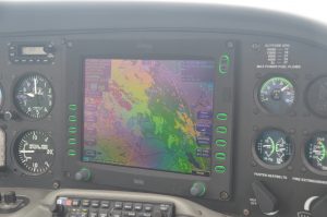
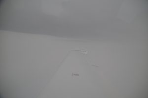
A few minutes after our departure, NEXRAD gave us a very good surprise. The hole through which we were going to fly was getting bigger and rain intensity through it was going down. Out the windshield we were flying in clear skies and 30 kts tailwinds. After a couple hundred miles we entered IMC conditions at 8,000 ft, with light precipitation. The ride was smooth, the stormscope and NEXRAD showed lightning at least 50 miles away, and conditions seemed to be improving on our route. After a short discussion with Evansville approach we changed our destination to Davenport, IL (DVN), and seeing conditions improve, we switched again to an airport further west with cheap fuel: Cherokee county (CKP).
Once we crossed the storm, which entailed 1.5 hours of IMC, the next issue were high surface winds below us. Places near the storm were reporting gusts higher than 30 kts. Our destination was reporting 16 kts, gusts to 21, much more manageable considering that they were mostly down the runway. The next stage of our plan, should landing at CKP proved difficult due to winds, was to fly north, where the winds were milder and severe VFR prevailed. Our flight time to CKP would be 4.0 hours, leaving us a healthy 200 nm range to find better winds and land with VFR reserves.
As we approached Cherokee county the wind was blowing at about 15 kts, but with very little turbulence. I haven’t flown much in flat-country, but now I realize that landing with wind is much less challenging when you deal with a constant flow, rather than the constant chop. Our first landing was smooth and uneventful, and soon we were parked at the self-serve fuel station, taking in 50 gallons at about 4.00 $/gallon. The leg ended up being cheap, though such “opportunities” come at a price: the FBO was empty, and the bathroom was broken – don’t ask about how we solved that problem. They had instantaneous chocolate available in a machine, which we took as our lunch for the day.
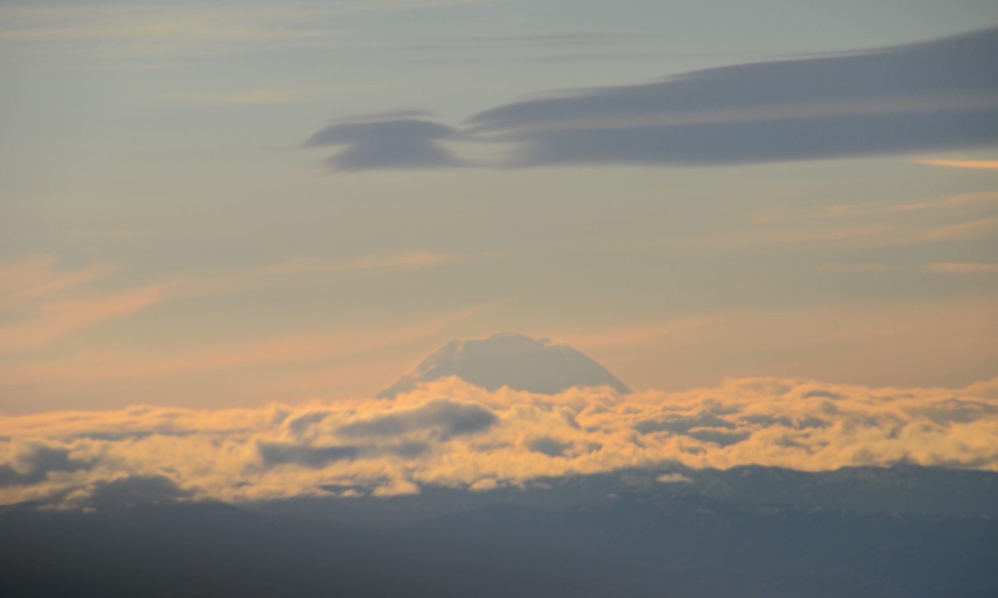
Without further delay, under blue skies and with about 5 hours of sunlight available, we departed VFR towards Cody, WY (COD). It was 4:00 PM, and we couldn’t help but notice Rapid City was right on our path. If we wanted to take a look at Mount Rushmore, a stop there might be worthwhile. We decided to fly towards Rapid City and delay our decision of whether to push or not to Cody once we got there. Off we went!