Flight Date: April 30, 2017
The Jackson Hole challenge.
Departure: RAP
Destination: IDA (we planned for WYS, but switched to JAC and then to IDA)
Engine on: 10:00 AM MDT
Hobbs: 3.5
Gallons: 44.30
Distance: 393 nm
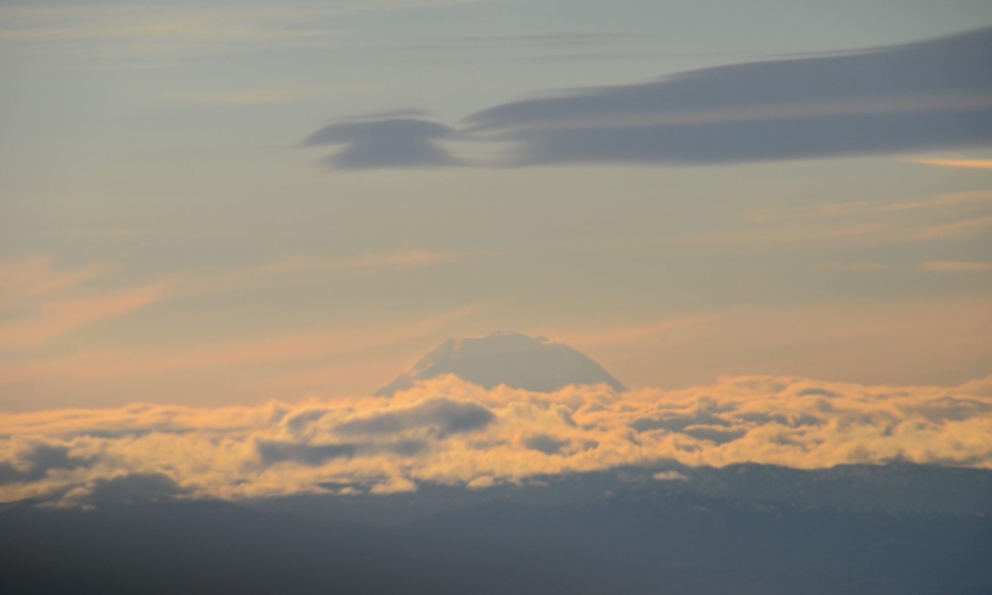
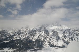
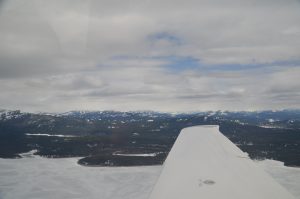
Our excitement of having just crossed Togwotee pass was soon to fade after observing the very different weather awaiting us on the other side of the mountain. Straight ahead of us over the Grand Teton range, and extending north towards Yellowstone, we saw what appeared to be visibility-crippling snow showers. My first thought was that we would have to turn around. Five minutes in the opposite direction would yield another look at the pass and blue skies.

Very quickly, however, I noticed that visibility in the valley to our right was unobstructed and I could see the small hill that lies north east of the Jackson Hole airport (multiple landings in commercial airliners and several sightseeing breaks while skiing in nearby resorts gave me a familiarity with the area that proved helpful during this flight). Thus, the most plausible plan became to land at the airport and wait for better weather to continue. As we flew towards the mountains visibility improved, allowing us to ask from tower for a transition clearance to perform a sightseeing flight, rather than a landing clearance. We got close and personal with the range, still unable to see Grand Teton in its whole extension.
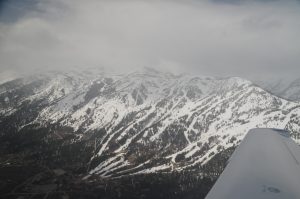
I also got to see the places where I took those skiing breaks, this time from the air. As we got closer we could see the resort was closed and that multiple ski pistes had no snow in them.
After flying south and north along the Grand Teton range, decision time arrived: should we land in Jackson Hole airport, or should we continue west towards Idaho’s lowlands? If continue, should we try to fly VFR-on-top, or continue VFR below the ceiling as we were currently doing?
Landing at Jackson would potentially delay us enough to force us to spend the night there. Maybe even more than one night. At 6.69 $/gallon, gas at the airport is the most expensive one can find a few hundred miles around; we would have to figure out transportation to town, and compete for a room with ski enthusiasts (from the resorts that remained open). Basically, this stop was going to be expensive.
The stop would also potentially make the rest of the trip less enjoyable. Delaying our trip would entail foregoing the favorable weather forecasted en-route (the apparently poor one surrounding us notwithstanding), with large H marked in the prog charts around us. Should a big L be moving in, the beautiful sights we were enjoying might not be available. We had the capacity to depart IFR, use the oxygen we had bought for the trip, and plow through inside a cloud; but with freezing temperatures surrounding us, lack of FIKI capabilities meant we might not be able to do it.
Bottom line: landing at Jackson would be potentially very inconvenient. But, of course, I’ll take any inconvenience over finding myself flying VFR with low visibility in mountainous terrain.
The cloud layer on top of us was thin, we could climb through one of the holes, or even better, get an IFR clearance to get on top, continue VFR-on-top, turn west, and then descend as soon as practical. This solution would entail opening the brand new, unused, oxygen system we were carrying for the trip. The plane could take us to 18,000 ft, and the oxygen would make it safe and legal. Climbing immediately was better than attempting it later because outside temperature was high enough that icing would not be a problem. However, I had been hoping to not need the oxygen and to return it unused. The oxygen option would cost $450.
Time to enlist some help. We flew north of Jackson to Jackson lake. There we circled while we called Casper radio to get a weather update. In the more than 15 years I’ve been enjoying the privilege of flying in the United States, I have seldom used flight services. The instructor who took me from nothing to a private pilot’s license taught me how to open and close a flight plan with them, and explained they were always available to help with weather real time. However, as a student one never flies in anything less than almost-perfect weather, so their usefulness is limited. As I advanced with instrument training, I also started flying with NEXRAD, providing most of the information one would need during a flight when the weather is less-than-perfect.
This time NEXRAD was not offering what I needed to know. I could see areas of precipitation – and that seemed to be snow – out the windshield. Yet, NEXRAD was not showing anything. If one believed the image, skies were clear and the sun was shining; but that didn’t correspond with reality. At the same time, I could see blue skies to the northwest, and Idaho’s lowlands below the horizon. As long as the weather we were witnessing was not part of a larger system, we could safely fly west. But if behind the precipitation more bad weather followed, the wise move would be to turn back and land at Jackson.
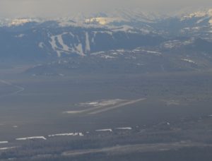
Casper radio provided a reassuring report. Ceilings at the closest airports, 50 nm west of our current position, were all reporting 7,000 ft broken ceilings (implying 11,000 ft MSL) with more than 10 nm visibilities. The forecast was all of improving weather. No one had reported anything that would seem to affect our flight negatively. Beyond the weather we were witnessing, centered west of the Grand Teton – we were flying on the east side of the range—nothing else was going on.
Casper also clarified an important mistake I had done earlier. My original VFR flight plan had West Yellowstone airport (WYS) as its destination. In reading the notams I had skimmed through “AD AP closed”, thinking it referred to some taxiway. Well, the airport was closed, the “AP” was short for airport. Had the weather been nice we might have blown off that Notam. Thank you, Casper. Lesson learned!
Armed with this information, we filed a new VFR plan with Casper and decided to continue our VFR flight. The plan was to continue north of Jackson lake for a few miles until the range on which the Grand Teton lies ends, and then turn west towards Idaho falls, about 80 nm miles west.
As we flew north, we were tempted to go towards Yellowstone in an attempt at catching a glimpse of Old Faithful and Grand Prismatic. Alas, what seemed a small snow shower in that direction convinced us to ditch Yellowstone and fly west towards Idaho falls. Overflying Yellowstone will require another trip.
Our route now offered excellent visibility, opaqued only to our left, where small showers were bathing the Grand Teton. We enjoyed the scenery, and less than 5 minutes later we were over Idaho’s flatlands under a scattered layer a few thousand feet above us.
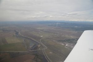
We landed in Idaho falls, where a very friendly crew provided us with a courtesy car and directions to a local favorite. We enjoyed our 2:00 PM breakfast as we planned our next leg. The question was, should we stop near Boise, or somewhere beyond?